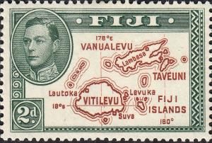
map of Fiji Islands & King George VI
|
Short desc: map of Fiji Islands & King George VI
Things in this design: map map of Fiji Islands (syn. of map of Fiji) person King George VI |
Record of changes |
|
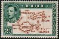
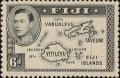
Short desc: map of Fiji Islands & King George VI
Things in this design: map map of Fiji Islands (syn. of map of Fiji) person King George VI |
Record of changes |