Image Colnect-2221-540-Map-of-Netherlands.jpg
(1024 x 665 pixels) |
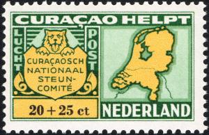
Type: stamp Issuer: Netherlands Antilles Date: 1946 Denom: ?
Visibility: public Image owner: none airmail semipostal 7/1/1946 20+25c multi issue=1946 air semi d=Map of Netherlands unwmk perf=11x11.5 Crops No visible images cropped from this one. Measurements Resolution is unknown. Source Source name: Colnect File URL: http://i.colnect.net/images/b/2221/540/Map-of-Netherlands.jpg Uploaded July 7, 2016, 7:25 pm by Stan Shebs |