Image Colnect-4091-851-World-Map-on-van-der-Grinten--s-Projection.jpg
(316 x 473 pixels) |
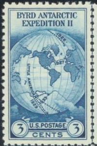
Type: stamp Issuer: United States Date: 1933 Denom: ?
Visibility: public Image owner: none postage 10/9/1933 3c dkbl issue=Byrd Antarctic Expedition d=map of expedition routes unwmk perf=11 Crops No visible images cropped from this one. Measurements Resolution is unknown. Source Source name: Colnect File URL: http://i.colnect.net/b/4091/851/World-Map-on-van-der-Grinten--s-Projection.jpg Uploaded June 17, 2017, 2:59 pm by Stan Shebs |