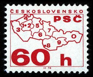
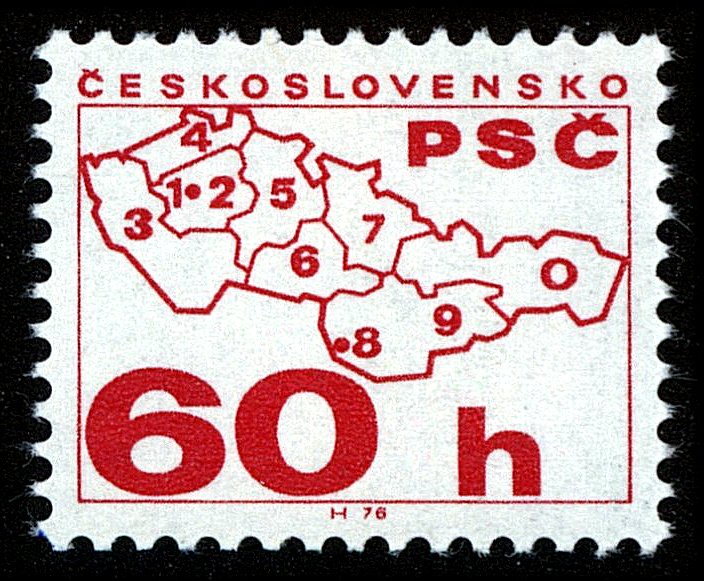
Image Colnect-4012-221-Map-with-the-postcode-regions.jpg
(704 x 581 pixels) |
Type: stamp Issuer: Czechoslovakia Date: 1976 Denom: ?
Visibility: public Image owner: none postage 9/7/1976 60h car issue=Postal Code Campaign d=Map with the postcode regions unwmk perf=11.25x11.75 Crops No visible images cropped from this one. Measurements Resolution is unknown. Source Source name: Colnect File URL: http://i.colnect.net/b/4012/221/Map-with-the-postcode-regions.jpg Uploaded November 1, 2017, 5:06 pm by Stan Shebs |