Image Colnect-4518-613-Map-of-Tongatabu.jpg
(913 x 602 pixels) |
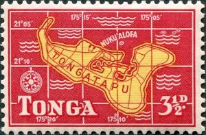
Type: stamp Issuer: Tonga Date: 1953 Denom: ?
Visibility: public Image owner: none postage 7/1/1953 3 1/2p car&yel issue=1953 d=Map of Tongatabu wmk=mult crown & script CA Crops No visible images cropped from this one. Measurements Resolution is unknown. Source Source name: Colnect File URL: http://i.colnect.net/b/4518/613/Map-of-Tongatabu.jpg Uploaded July 17, 2018, 8:38 pm by Stan Shebs |