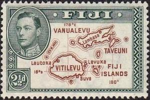
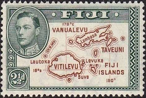
Image Colnect-1102-059-Map-of-Fiji-Islands.jpg
(471 x 317 pixels) |
Type: stamp Issuer: Fiji Date: 1940 Denom: ?
Visibility: public Image owner: none postage 4/5/1938 2 1/2p grn&brn issue=George VI pictorials d=map of Fiji Islands & King George VI wmk=mult crown & script CA Crops No visible images cropped from this one. Measurements Resolution is unknown. Source Source name: Colnect File URL: http://i.colnect.net/b/1102/059/Map-of-Fiji-Islands.jpg Uploaded August 19, 2014, 2:58 pm by Stan Shebs |